News & Insights
Digital Edge – AI powered progress tracking
At Mercury, we are trialing a number of innovative 360 photo documentation software options to identify the best fit for our projects. 360 cameras allow the user to capture their entire surroundings in one swoop. These images, known as photospheres, can contain the same information as up to 11 traditional photographs.
Typically, project progress is documented by capturing a series of still visuals. This process is often regarded by industry experts as tedious and inefficient and can result in the production of photos that do not display every detail of a project.
Issues such as storing, cataloging, and retrieving information can also occur using this process and it can be difficult for project stakeholders to understand where and when a photo was taken and important information can be misplaced or misinterpreted.
With 360 photo documentation software, visuals are automatically stitched and mapped to the project floor plan to create a 3D digital image that can be navigated by project management.
These 360-degree walkthroughs capture the status of the project at different points in time, allowing users to travel back and forth in the construction process to review and compare progress. These walkthroughs are particularly useful for conducting weekly site meetings and in providing progress updates to people who are unable to attend in-person meetings or complete site walks.
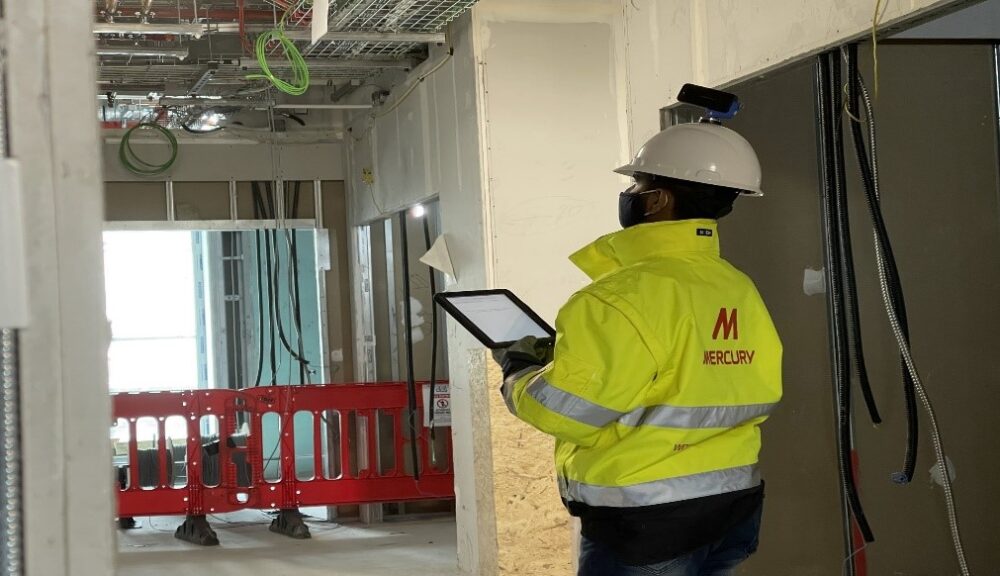
The software options integrate seamlessly with Mercury’s construction management software BIM360, allowing users to provide the required backup to observations, issues, and snags on our existing systems.
We are reviewing and trialing the following software options: Openspace, HoloBuilder, and Drone Deploy.
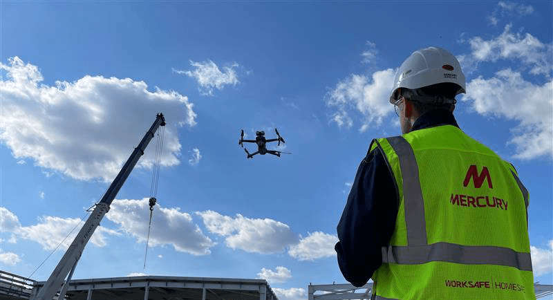
Both HoloBuilder and Openspace utilize 360 cameras that map site walks to associated 2D drawings and are ideal for capturing the internal status of our projects. Drone Deploy has the additional benefit of capturing drone images of external site progress.
The most appropriate software depends on the type of project at hand. For example, in large-scale General Contractor projects, where drone images are becoming the norm, Drone Deploy offers the best option.
In terms of internal walkthroughs, OpenSpace is the most straightforward and seamless to use and produces the best photo/video output which is automatically mapped to 2D drawings.
Drone Deploy is currently being used on our Data Centre projects in Warsaw and Milan. Holobuilder is being used on a short-term data center project in London and OpenSpace is being used on five projects across Ireland, Germany, Sweden, and France.
Digital Edge – A Beyond50 Pillar
The AI photo documentation programme forms part of Mercury’s Beyond50 strategy, as part of the ‘Digital Edge’ pillar. Digital Edge aims to ensure that our frontline people have the right technology to enable them to deliver real value to our clients, pushing digital construction to the edge. Read more about innovation in Mercury here.
OUR BEYOND50 STRATEGY DESIGN, QUALITY & INNOVATION
Like Mercury on Facebook.
Follow us on LinkedIn, Twitter, and Instagram.