Nachrichten und Einblicke
Precision laser measurement with a cutting edge
Building Information Modelling (BIM) has revolutionised the construction industry by allowing designers and engineers to collaborate on 3D models that possess significant volumes of accurate and intelligent data.
However, when it comes to translating this data to the field, contractors still rely on manual methods for setting out, such as tape measures and string which can be inefficient and lead to inaccuracies.
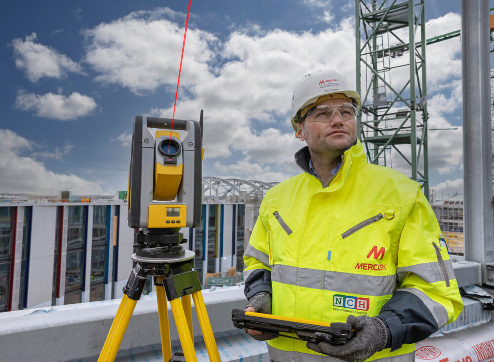
At Mercury, we are leveraging the use of digital technology on our project sites to maintain our „Right First Time“ ethos. These use of the Trimble’s 3D Robotic Total Station (RTS) brings the precision of 3D modelling to the field, improving efficiency and reducing costs.
The RTS allows contractors to import their 3D models, and accurately layout all points to be marked on site. This allows our people to utilise laser measuring to pinpoint locations from the 3D model to within 1.5mm tolerance over 100 metres, using a tablet interface to select each point, and in turn mark where the laser indicates.
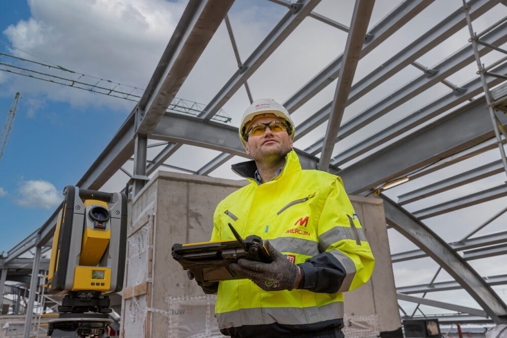
What is the Trimble Robotic Total Station?
The Trimble Robotic Total Station (RTS) is a total station that contains a high-powered laser that visually marks points quickly, at greater range. A lone operator has the ability to perform considerably more verification inspections to a higher standard. The use of the Trimble Robotic Total Station device helps us perform layout tasks up to five times faster than conventional methods whilst increasing accuracy.
The advanced technologies incorporated in the RTS 773 Robotic Total station ensures accurate and prompt layout , guaranteeing that design intent is executed correctly the first time. Trimble SurePoint Technology ensures accurate measurements by automatically correcting for unwanted movement due to wind, sinkage, and other factors.
What are the Benefits
The use of the Robotic Total Station brings the precision of the 3D models to the field, saving time and improving cost efficiency. It allows contractors to import their 3D Models and accurately layout all the points to be marked on site. A single person can use the RTS’s laser measuring system to pinpoint locations from the 3D model to within 1.5mm tolerance over 100meters using a tablet interface to select each point and in turn mark where the laser indicates.
The Trimble RTS directly integrates with Trimble FieldLink which facilitates easy management of the complete construction layout and as-built collection process. Integration with Trimble VISION allows us to view the live images captured from the Total Station remotely via a tablet enabling more efficient communication from office to field.
Not only does the RTS provide benefits in productivity and quality assurance through its accuracy, speed and reliability, this technology leads to productivity gains throughout the project life cycle. This technology is utilised from design and planning to layout, all the way through to construction handover.
Digital Edge – A Beyond50 Pillar
This project forms part of Mercury’s Beyond50 strategy, as part of the ‘Digital Edge’ pillar. Digital Edge aims to ensure that our frontline people have the right technology to enable them to deliver real value to our clients, pushing digital construction to the edge.
Like Mercury on Facebook.
Follow us on LinkedIn, Twitter, and Instagram.